Earlier this year, in the February News, the More Mesa Preservation Coalition reported that More Mesa was for sale … for $110 Million. Shortly after this sale offering appeared in the “Multiple Listings”, the owner contracted with a local company to survey the property. The “poles” and flags” that may be seen in various areas of More Mesa, are the result of that survey work. These markers delineate the six parcels that comprise the 265 acres of More Mesa; parcels that range in size from 12.9 acres to 106.6 acres.
A parcel map of these six areas is shown below. The sale offering states that any of these parcels may be purchased separately, or they may all be purchased together as a block. The only “developable” 40 acres of More Mesa lie in an “L” shaped area along the eastern and northern edges of the property (see /development-threat/). This developable area is within Parcel #8, the largest parcel of the six.
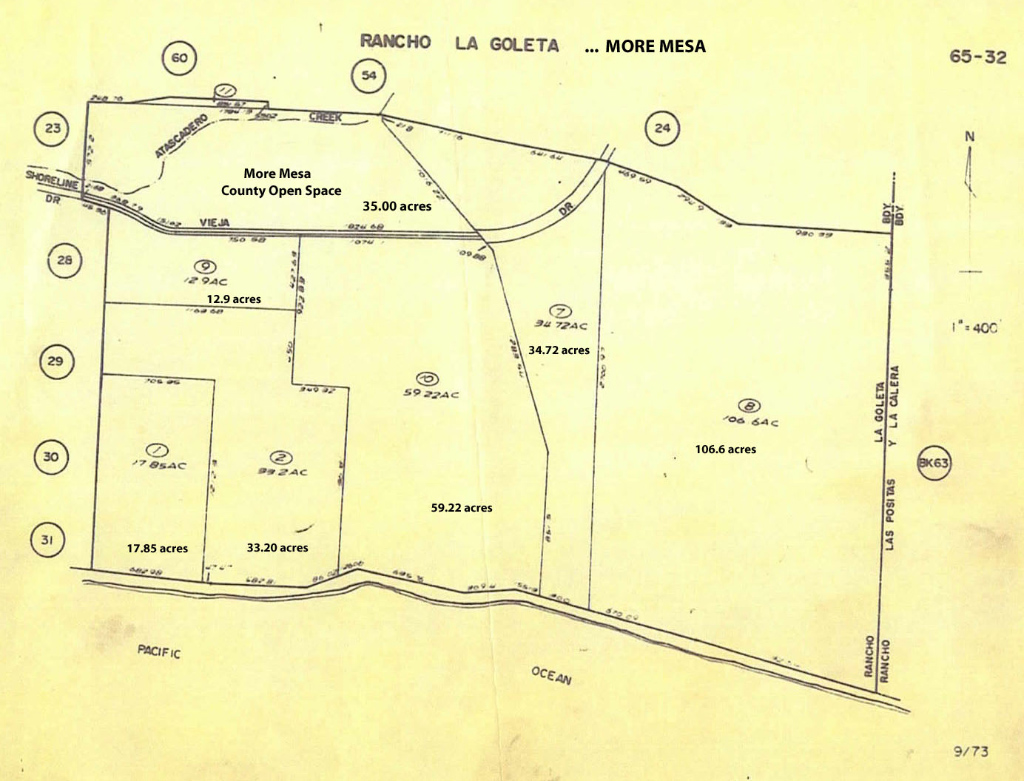
More Mesa Survey Map – Click on map for a larger version