ABOUT
Our Mission
We are a coalition of neighbors, conservationists, scientists, planners, students, hikers, runners, equestrians, cyclists, beachgoers, and concerned residents who believe that once natural coastal land is lost, it cannot be replaced. More than 1,000 supporters have signed on to stay informed and take action, representing a broad cross-section of the Goleta Valley community and the South Coast.
The More Mesa Preservation Coalition is a community-based organization dedicated to preserving More Mesa in perpetuity as protected open space. For more than two decades, we have worked to ensure that this extraordinary coastal landscape remains wild, accessible, and safeguarded for future generations.
What We Do
- Monitor development proposals that could impact More Mesa’s ecological, recreational, and scenic values
- Advocate, educate, and collaborate to protect the mesa’s essential character
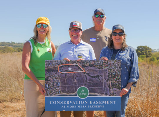
- Work toward acquiring the remaining 265 acres for permanent preservation
Our long-term goal
To acquire the remaining 265 privately owned acres and permanently protect the entire mesa and beach as open space.
Who’s Behind the Work
The More Mesa Preservation Coalition is led by a dedicated volunteer board of community members committed to protecting More Mesa for generations to come.
What is More Mesa?
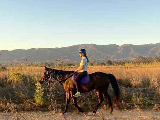
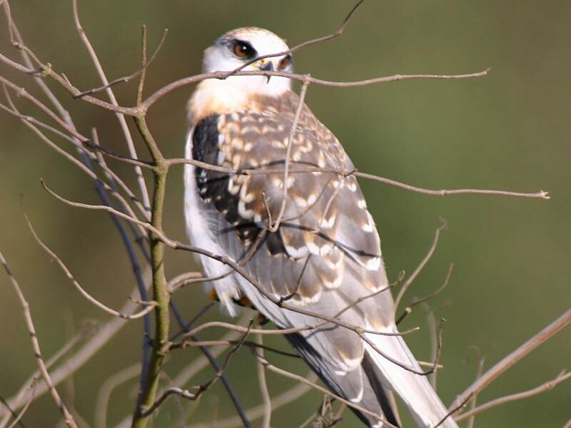
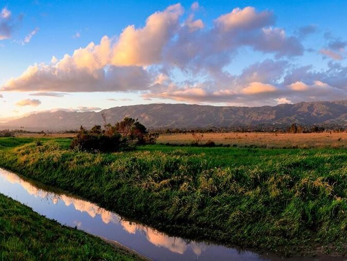
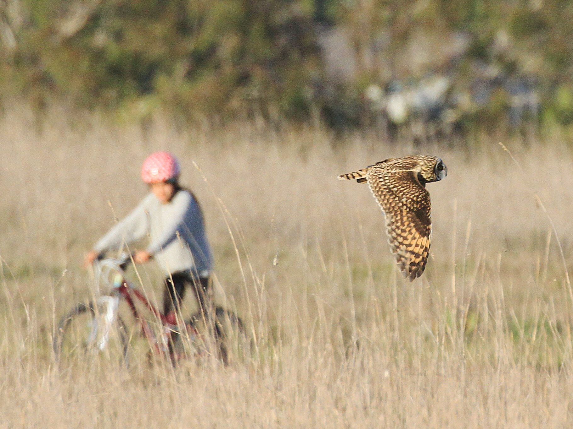
More Mesa is one of the most remarkable scenic and environmentally sensitive undeveloped open spaces remaining on the Southern California coast. Its coastal bluff-top grasslands provide valuable wildlife habitat and more than ten miles of natural surface trails, including over two miles of dedicated public access paths. With sweeping views of the Santa Ynez Mountains and the Pacific Ocean, the mesa fronts one of the largest and most pristine sandy beaches on Santa Barbara County’s South Coast.
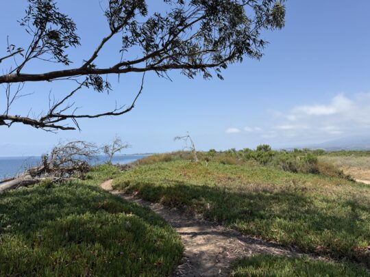
Located in the eastern Goleta Valley, More Mesa is bordered by Hope Ranch to the east, More Mesa Shores to the west, and established residential neighborhoods to the north. Just two miles east of Goleta Beach County Park and UCSB, it offers the only publicly accessible coastal trail spanning nearly five miles between Arroyo Burro Beach and Goleta Beach. Despite its highly desirable location and numerous past development proposals, this coastal landscape remains undeveloped. Its future, however, is not guaranteed.
More Mesa encompasses approximately 330 acres of both privately and publicly owned land. The largest portion, 265 acres, remains privately owned and includes most of the level mesa, canyons, and the entire coastal bluff-top. The County of Santa Barbara owns an adjacent 54 acres designated as More Mesa Open Space, including oak woodlands, wetlands, and riparian habitat along Atascadero Creek. An additional 12 acres at the western end of the mesa remain privately owned and contain bluff habitat, oak-covered slopes, and key informal access trails.
Together, these lands form one of the last intact coastal open spaces of its kind — a rare landscape where habitat, public access, and sweeping coastal beauty still exist side by side.
Read More About More Mesa
Ecology
A closer look at the coastal habitats, oak woodlands, wetlands, and wildlife that depend on permanent protection.
Explore Ecology →
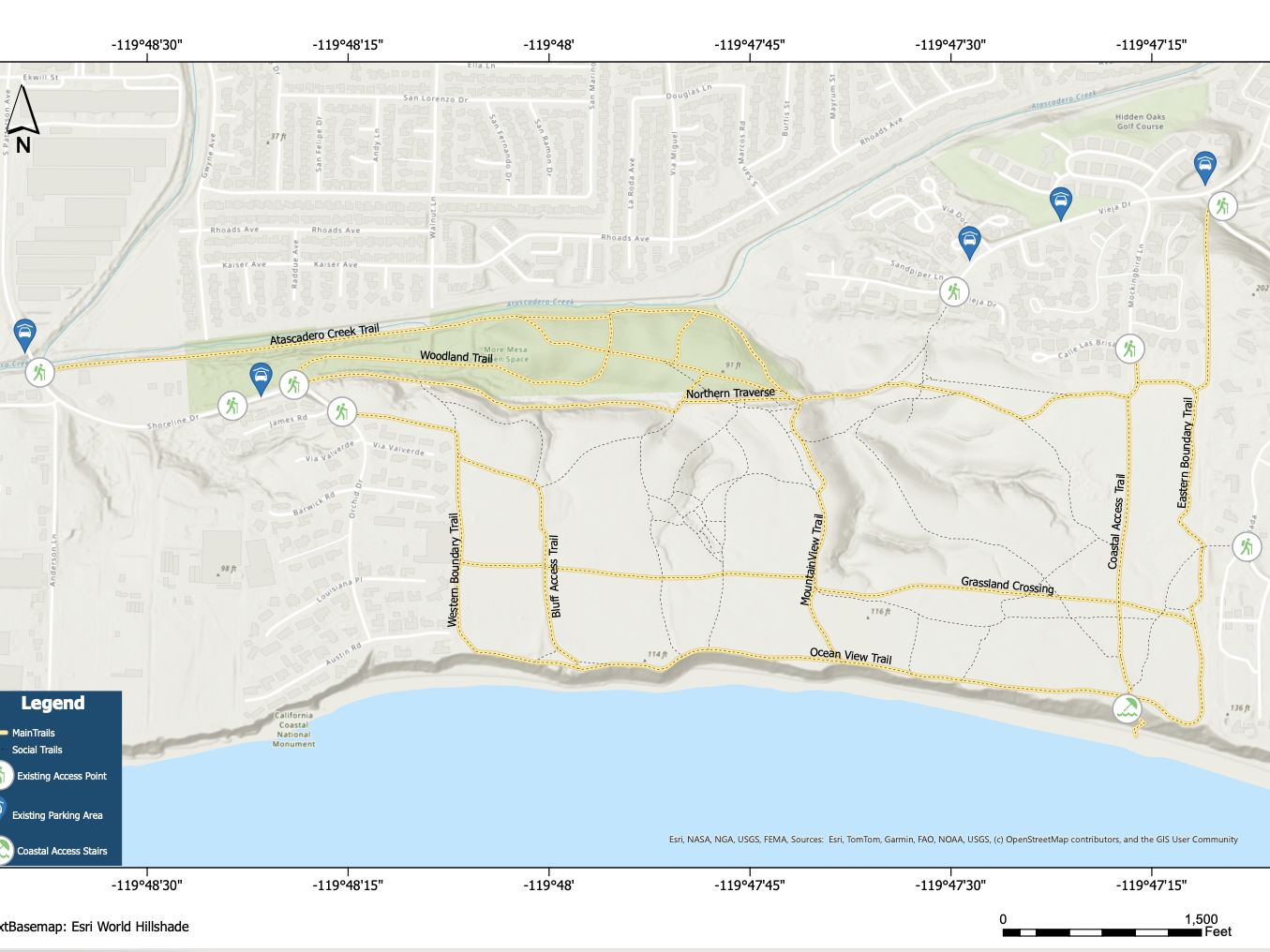
Access Map
Interactive tools to navigate trails, bluff paths, and public entry points throughout the mesa.
View the Map →
History
A look at the milestones, advocacy efforts, and community action that have defined More Mesa’s preservation journey.
Learn More →
Development Threat
An overview of the proposals, ownership realities, and challenges that continue to shape the future of the mesa.
Learn More →
Recreation
Information about trails, public access, and the many ways the community experiences More Mesa.
Explore Recreation →